Mundo Topográfico M² Logo

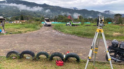
Mundo Topografico m² is a Colombia-based topography and cadastral services firm that delivers precise surveying, mapping and urban planning solutions across the country. The firm specializes in high-precision topographic surveys, cartography, 3D photogrammetry with drones, and the delineation of property boundaries to support real estate development, infrastructure projects and private sector initiatives.

The firm benefits from a team of professionals including a topographic engineer, technicians and technologists, cartographers, GIS specialists, data analysts, and project coordinators, all dedicated to delivering high quality results with rigorous quality control and timely project delivery.

In addition to technical surveying, Mundo Topografico m² offers juridical and cadastral services such as area and boundary rectification, cadastre updates, and legal support for property projects in Pach o and Cundinamarca, reflecting an integrated approach to property development that aligns technical data with regulatory requirements.

Über Mundo Topográfico M²
Rechtsgebiete
Immobilienrecht
Klagen & Streitigkeiten
Gesellschafts- und Handelsrecht
Unternehmen

Gesprochene Sprachen
English

Soziale Medien

KOSTENLOSE FRAGE STELLEN

Kostenlos • Anonym • Experten-Anwälte

Brauchen Sie rechtliche Unterstützung?

Verbinden Sie sich mit erfahrenen Anwälten in Ihrer Region für eine persönliche Beratung zu Ihrem Fall.

Kostenlos und unverbindlich.

Rechtsgebiete

Immobilienrecht

Mundo Topografico m² provides comprehensive Real Estate oriented services that combine precise topographic surveying, englobes of predios, rectification of area and linderos, and cadastre related updates to support property transactions, development and regulatory compliance.
Gewerbeimmobilien
Wohnen, Bauen & Entwicklung
Zwangsversteigerung
Flächennutzung und Zonierung
Vermieter & Mieter
Hypothek
Immobilien-Due-Diligence
Immobilienverträge und Verhandlungen
Maklerdienstleistungen
Immobilienübertragung

Klagen & Streitigkeiten

Lawsuits & Disputes support includes legal oriented topography and cadastral work such as area and boundary rectifications and cadastre updates to resolve property disputes and align registries with physical boundaries, in coordination with IGAC and local cadastral authorities.
ADR-Mediation und Schiedsgerichtsbarkeit
Berufung
Sammelklage
Allgemeine Prozessführung
Ethik und berufliche Verantwortung
Wirtschaftsstreitigkeiten
Kartellrechtsstreit
Restrukturierung & Insolvenz

Gesellschafts- und Handelsrecht

Corporate & Commercial services are supported by commercial valuations (avalós comerciales) that assess the value of properties, assets or businesses to inform corporate transactions, financing and due diligence processes.
Verwaltung
Admiralitäts- und Seerecht
Landwirtschaft
Kartellrecht
Luftfahrt
Unternehmensregistrierung
Vertrag
Due-Diligence-Prüfung
Franchiserecht
Gaming
Regierungsauftrag
Lizenzierung
Fusionen und Übernahmen
Transport
Risikokapital
Cannabisrecht
Gemeinnützige und Wohltätigkeitsorganisationen
Internationales Handelsrecht
Regierungsbeziehungen und Lobbyarbeit
Private Equity
Unternehmensführung
Sanktionen und Exportkontrollen

Unternehmen

Business services focus on valuations and related geospatial data that facilitate business decisions, including asset valuations and the transformation of topographic data into actionable insights for commercial activities.
Buchhaltung und Wirtschaftsprüfung
Kommunikations- und Medienrecht
Arbeitgeber
Gesundheitsversorgung
International
Rechtsdokument
Neugründung eines Unternehmens
Bürolösungen
Steuer
FDA-Recht