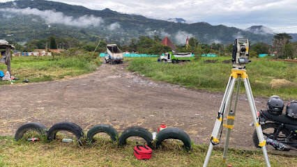
Mundo Topografico m² is a Colombia-based topography and cadastral services firm that delivers precise surveying, mapping and urban planning solutions across the country. The firm specializes in high-precision topographic surveys, cartography, 3D photogrammetry with drones, and the delineation of property boundaries to support real estate development, infrastructure projects and private sector initiatives.

The firm benefits from a team of professionals including a topographic engineer, technicians and technologists, cartographers, GIS specialists, data analysts, and project coordinators, all dedicated to delivering high quality results with rigorous quality control and timely project delivery.

In addition to technical surveying, Mundo Topografico m² offers juridical and cadastral services such as area and boundary rectification, cadastre updates, and legal support for property projects in Pach o and Cundinamarca, reflecting an integrated approach to property development that aligns technical data with regulatory requirements.

Acerca de Mundo Topográfico M²
Áreas de práctica legal
Bienes raíces
Litigios y disputas
Corporativo y Comercial
Negocios

Idiomas hablados
English

Redes sociales

HACER UNA PREGUNTA GRATIS

Gratis • Anónimo • Abogados Expertos

¿Necesita Ayuda Legal Personal?

Conéctese con abogados experimentados en su área para obtener asesoramiento personalizado sobre su situación específica.

Sin obligación de contratar. Servicio 100% gratuito.

Áreas de práctica legal

Bienes raíces

Mundo Topografico m² provides comprehensive Real Estate oriented services that combine precise topographic surveying, englobes of predios, rectification of area and linderos, and cadastre related updates to support property transactions, development and regulatory compliance.
Bienes raíces comerciales
Vivienda, Construcción y Desarrollo
Ejecución hipotecaria
Uso del suelo y zonificación
Propietario y Arrendatario
Hipoteca
Debida diligencia inmobiliaria
Contratos y Negociaciones Inmobiliarias
Corretaje
Gestión de la transferencia de propiedad

Litigios y disputas

Lawsuits & Disputes support includes legal oriented topography and cadastral work such as area and boundary rectifications and cadastre updates to resolve property disputes and align registries with physical boundaries, in coordination with IGAC and local cadastral authorities.
Mediación y Arbitraje ADR
Apelación
Acción colectiva
Litigio general
Ética y Responsabilidad Profesional
Litigación Comercial
Litigio antimonopolio
Reestructuración e Insolvencia

Corporativo y Comercial

Corporate & Commercial services are supported by commercial valuations (avalós comerciales) that assess the value of properties, assets or businesses to inform corporate transactions, financing and due diligence processes.
Administrativo
Almirantazgo y marítimo
Agricultura
Antimonopolio
Aviación
Registro de empresas
Contrato
Debida diligencia
Franquicias
Juegos de azar
Contrato gubernamental
Licencias
Fusiones y Adquisiciones
Transporte
Capital de riesgo
Derecho del cannabis
Organizaciones sin fines de lucro y benéficas
Derecho del Comercio Internacional
Relaciones gubernamentales y cabildeo
Capital privado
Gobierno corporativo
Sanciones y Controles de Exportación

Negocios

Business services focus on valuations and related geospatial data that facilitate business decisions, including asset valuations and the transformation of topographic data into actionable insights for commercial activities.
Contabilidad y Auditoría
Derecho de las Comunicaciones y los Medios
Empleador
Atención médica
Internacional
Documento legal
Constitución de nuevas empresas
Soluciones para oficinas
Impuestos
Ley de la FDA